![](/images/other/stat-length.png)
![Trail On foot Hohenberg an der Eger - Hohenberg 3 - Photo](https://media.geolcdn.com/t/1900/400/ext.pjpeg?maxdim=2&url=https%3A%2F%2Fmedia.geolcdn.com%2Ff%2F175e67bc-1377-44a3-95b9-ce0dcc591fa1.jpeg)
Hohenberg 3
SityTrail - itinéraires balisés pédestres
Tous les sentiers balisés d’Europe PRO
![Length](/images/other/stat-length.png)
Length
10.9 km
![Max alt](https://static1.geolcdn.com/siteimages/upload/files/1508320355ic_sort_altitude_max_24dp.png)
Max alt
622 m
![Uphill gradient](https://static1.geolcdn.com/siteimages/upload/files/1508320355ic_sort_den_pos_24dp.png)
Uphill gradient
228 m
![Km-Effort](/images/other/stat-length.png)
Km-Effort
13.9 km
![Min alt](https://static1.geolcdn.com/siteimages/upload/files/1508320355ic_sort_altitude_min_24dp.png)
Min alt
508 m
![Downhill gradient](https://static1.geolcdn.com/siteimages/upload/files/1508320355ic_sort_den_neg_24dp.png)
Downhill gradient
230 m
![Boucle](https://static1.geolcdn.com/siteimages/upload/files/16400158638029165_repeat_loop_refresh_sync_direction_icon.png)
Boucle
No
Signpost
Creation date :
2022-02-11 14:26:55.705
Updated on :
2022-02-11 14:26:55.705
![On foot](https://static1.geolcdn.com/sitytour/trail-icons/100.png)
3h09
Difficulty : Easy
![Scan this QR Code to open this trail in the SityTrail application](https://capi.geolives.com/qq0zvz2zws4bq2lad0pu/sitytour/trails/3092640/qr.png?size=200)
FREE GPS app for hiking
About
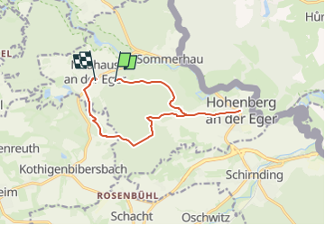
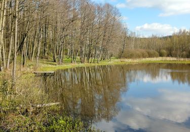
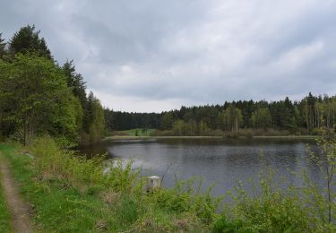
Trail On foot of 10.9 km to be discovered at Bavaria, Landkreis Wunsiedel im Fichtelgebirge, Hohenberg an der Eger. This trail is proposed by SityTrail - itinéraires balisés pédestres.
Description
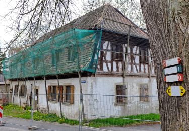
Symbol: weiße 3 auf grünem Grund
Positioning
Country:
Germany
Region :
Bavaria
Department/Province :
Landkreis Wunsiedel im Fichtelgebirge
Municipality :
Hohenberg an der Eger
Location:
Unknown
Start:(Dec)
Start:(UTM)
298018 ; 5554022 (33U) N.
Comments
Trails nearby
![Trail On foot Thiersheim - Mühlenweg - Photo](https://media.geolcdn.com/t/375/260/ext.jpg?maxdim=2&url=https%3A%2F%2Fmedia.geolcdn.com%2Ff%2F01720f9c-a96f-46fd-a209-317713a1cbaa.jpeg)
![On foot On foot](https://static1.geolcdn.com/sitytour/trail-icons/100.png)
Mühlenweg
On foot
Easy
Thiersheim,
Bavaria,
Landkreis Wunsiedel im Fichtelgebirge,
Germany
![](/images/other/stat-length.png)
6.9 km | 7.9 km-effort
1h 48min
![](https://static1.geolcdn.com/siteimages/upload/files/16400158638029165_repeat_loop_refresh_sync_direction_icon.png)
No
![Trail On foot Hohenberg an der Eger - Wanderweg 2 Hohenberg a.d. Eger - Photo](https://media.geolcdn.com/t/375/260/ext.jpg?maxdim=2&url=https%3A%2F%2Fmedia.geolcdn.com%2Ff%2Ff63c0798-986c-4da6-8859-647a7ebe631c.jpeg)
![On foot On foot](https://static1.geolcdn.com/sitytour/trail-icons/100.png)
Wanderweg 2 Hohenberg a.d. Eger
On foot
Easy
Hohenberg an der Eger,
Bavaria,
Landkreis Wunsiedel im Fichtelgebirge,
Germany
![](/images/other/stat-length.png)
4 km | 5 km-effort
1h 7min
![](https://static1.geolcdn.com/siteimages/upload/files/16400158638029165_repeat_loop_refresh_sync_direction_icon.png)
No
![Trail On foot Hohenberg an der Eger - Wanderweg 1 Hohenberg a.d. Eger - Photo](https://media.geolcdn.com/t/375/260/ext.jpg?maxdim=2&url=https%3A%2F%2Fmedia.geolcdn.com%2Ff%2Fdc15ae97-3c51-40b0-b17d-17e5cbcabf43.jpeg)
![On foot On foot](https://static1.geolcdn.com/sitytour/trail-icons/100.png)
Wanderweg 1 Hohenberg a.d. Eger
On foot
Easy
Hohenberg an der Eger,
Bavaria,
Landkreis Wunsiedel im Fichtelgebirge,
Germany
![](/images/other/stat-length.png)
6.1 km | 8.1 km-effort
1h 49min
![](https://static1.geolcdn.com/siteimages/upload/files/16400158638029165_repeat_loop_refresh_sync_direction_icon.png)
Yes
![Trail On foot Schirnding - Wanderweg 3 Schirnding - Photo](https://media.geolcdn.com/t/375/260/ext.jpg?maxdim=2&url=https%3A%2F%2Fmedia.geolcdn.com%2Ff%2F9b6340b8-9512-4c71-9429-f76d5976acbd.jpeg)
![On foot On foot](https://static1.geolcdn.com/sitytour/trail-icons/100.png)
Wanderweg 3 Schirnding
On foot
Easy
Schirnding,
Bavaria,
Landkreis Wunsiedel im Fichtelgebirge,
Germany
![](/images/other/stat-length.png)
3.3 km | 4.1 km-effort
55min
![](https://static1.geolcdn.com/siteimages/upload/files/16400158638029165_repeat_loop_refresh_sync_direction_icon.png)
Yes
![Trail On foot Schirnding - Wanderweg 4 Hohenberg a.d. Eger - Photo](https://media.geolcdn.com/t/375/260/ext.jpg?maxdim=2&url=https%3A%2F%2Fmedia.geolcdn.com%2Ff%2F175e67bc-1377-44a3-95b9-ce0dcc591fa1.jpeg)
![On foot On foot](https://static1.geolcdn.com/sitytour/trail-icons/100.png)
Wanderweg 4 Hohenberg a.d. Eger
On foot
Easy
Schirnding,
Bavaria,
Landkreis Wunsiedel im Fichtelgebirge,
Germany
![](/images/other/stat-length.png)
6.9 km | 8.5 km-effort
1h 55min
![](https://static1.geolcdn.com/siteimages/upload/files/16400158638029165_repeat_loop_refresh_sync_direction_icon.png)
Yes
![Trail On foot Thiersheim - Wanderweg 4 Thiersheim - Photo](https://media.geolcdn.com/t/375/260/ext.jpg?maxdim=2&url=https%3A%2F%2Fmedia.geolcdn.com%2Ff%2F2965c40e-d840-49a2-8722-f73dd83526d7.jpeg)
![On foot On foot](https://static1.geolcdn.com/sitytour/trail-icons/100.png)
Wanderweg 4 Thiersheim
On foot
Easy
Thiersheim,
Bavaria,
Landkreis Wunsiedel im Fichtelgebirge,
Germany
![](/images/other/stat-length.png)
5.6 km | 6.8 km-effort
1h 33min
![](https://static1.geolcdn.com/siteimages/upload/files/16400158638029165_repeat_loop_refresh_sync_direction_icon.png)
No
![Trail On foot Selb - 3 [Selb] - Photo](https://media.geolcdn.com/t/375/260/ext.jpg?maxdim=2&url=https%3A%2F%2Fmedia.geolcdn.com%2Ff%2Fa65d9baa-5712-430b-ad9a-ce39442ae678.jpeg)
![On foot On foot](https://static1.geolcdn.com/sitytour/trail-icons/100.png)
3 [Selb]
On foot
Easy
Selb,
Bavaria,
Landkreis Wunsiedel im Fichtelgebirge,
Germany
![](/images/other/stat-length.png)
6.4 km | 8.2 km-effort
1h 51min
![](https://static1.geolcdn.com/siteimages/upload/files/16400158638029165_repeat_loop_refresh_sync_direction_icon.png)
Yes
![Trail On foot Thiersheim - blau weiß diagonal Arzberg-Hohe Warte - Photo](https://media.geolcdn.com/t/375/260/ext.jpg?maxdim=2&url=https%3A%2F%2Fstatic1.geolcdn.com%2Fsiteimages%2Fupload%2Ffiles%2F1545311037marcheuse_200dpi.jpg)
![On foot On foot](https://static1.geolcdn.com/sitytour/trail-icons/100.png)
blau weiß diagonal Arzberg-Hohe Warte
On foot
Easy
Thiersheim,
Bavaria,
Landkreis Wunsiedel im Fichtelgebirge,
Germany
![](/images/other/stat-length.png)
5.4 km | 6.1 km-effort
1h 23min
![](https://static1.geolcdn.com/siteimages/upload/files/16400158638029165_repeat_loop_refresh_sync_direction_icon.png)
No
![Trail On foot Hohenberg an der Eger - Museumsweg: Blauer Punkt auf weißem Grund - Photo](https://media.geolcdn.com/t/375/260/ext.jpg?maxdim=2&url=https%3A%2F%2Fstatic1.geolcdn.com%2Fsiteimages%2Fupload%2Ffiles%2F1545311037marcheuse_200dpi.jpg)
![On foot On foot](https://static1.geolcdn.com/sitytour/trail-icons/100.png)
Museumsweg: Blauer Punkt auf weißem Grund
On foot
Easy
Hohenberg an der Eger,
Bavaria,
Landkreis Wunsiedel im Fichtelgebirge,
Germany
![](/images/other/stat-length.png)
8.3 km | 10.2 km-effort
2h 19min
![](https://static1.geolcdn.com/siteimages/upload/files/16400158638029165_repeat_loop_refresh_sync_direction_icon.png)
No